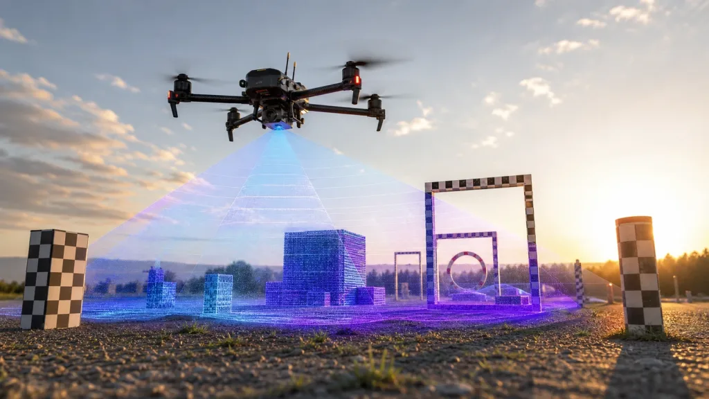
Flash LiDAR sounds attractive when a compact UAV or robotics team wants one depth frame that covers the whole scene without depending on a moving scan pattern. The shortlist usually goes wrong, however, when the team treats that architecture label as enough proof of fit and skips the harder questions about usable field coverage, ambient-light behavior, host-side data handling, and what evidence is needed before a sample request.
This guide is written for an integration lead or technical buyer screening 3D sensing options for a weight- and power-constrained platform. The goal is not to declare one architecture universally better. It is to decide whether Flash LiDAR deserves a place on your shortlist and what a realistic validation plan should look like before you spend engineering time.
| Quick answer | Shortlist Flash LiDAR only after you verify full-scene coverage, practical range under your lighting conditions, host-side data path, and the evidence required to compare it against a compact dToF module. |
|---|---|
| Best fit | Teams evaluating near-field obstacle awareness or spatial understanding on compact drones and embedded robots where snapshot-style scene capture is attractive but payload, power, and integration risk are tightly constrained. |
| Decision rule | If the vendor cannot show how scene-wide depth data remains usable across your real field of view, lighting, and data-ingest workflow, the architecture is still a research topic, not a shortlist-ready sensor. |
When Flash LiDAR belongs on a compact-platform shortlist
A Flash LiDAR concept is appealing because it aims to capture depth across a scene in one shot instead of building a scene through a mechanical sweep. That can matter when your platform is small, moving, and forced to react inside a short stopping distance. Recent primary-source work on SPAD-based dToF flash LiDAR highlights why teams keep revisiting the architecture: event-driven or asynchronous readout can reduce latency, cut redundant background data, and improve behavior in dynamic scenes when the rest of the system is designed correctly. You still have to prove the result at the system level, not just admire the architecture on paper.
The screening criteria should stay grounded in measurable evidence. NIST's roadmap for 3D imaging stresses field-of-view performance, measurement volume, ambient conditions, output quality, latency, repeatability, and the ability to resolve geometric features. Those are the right filters for a shortlist. ST's multizone Time-of-Flight guidance also reinforces a practical point: usable coverage depends on how the sensing geometry works in the real scene, not on a marketing bullet alone. If you need a primer before this comparison step, start with what drone LiDAR means for UAV integration teams. If your mission is already defined, the harder question is whether a flash-style architecture gives better evidence than a compact module you can integrate sooner.
For many small-platform teams, the real decision is not "Flash LiDAR or nothing." It is whether a full-scene architecture gives enough value over a compact embedded module to justify extra risk in optics, data rates, validation effort, or vendor maturity. That is why a factual baseline matters. Purpleriver's featured module is not presented as a Flash LiDAR product. It is a compact solid-state dToF reference point with known field of view, interfaces, power draw, and software support, which makes it useful when comparing architecture ambition against integration reality.
Flash LiDAR shortlist matrix for UAV and robotics teams
| Screening question | Why it matters | Pass signal | Red flag |
|---|---|---|---|
| Does the scene-wide depth frame cover the exact hazards you care about? | Flash-style capture is only valuable if the obstacle volume is actually inside the usable sensing envelope. | The vendor can map coverage against your stand-off distance, corridor width, or approach geometry. | You only receive a single diagonal FoV number with no scene model or target example. |
| What happens under real ambient light and surface reflectance? | Scene-wide illumination and detection still have to survive your lighting, materials, and background reflections. | The evaluation plan includes indoor or outdoor light conditions that match your deployment. | The demo is limited to a dark lab or clean wall with no reflectance discussion. |
| Can the host ingest the data without stalling the control loop? | Compact platforms lose the benefit of low-latency sensing if transport and parsing become the bottleneck. | The vendor can explain frame format, timing behavior, and the host interface path. | The data path is vague, proprietary, or unsupported on your target compute stack. |
| Do you need full-scene depth or just enough near-field awareness to make a decision? | A simpler module often wins when the actual task is near-field clearance, docking, or bounded obstacle checks. | The team can define which decision depends on scene-wide depth rather than a narrower sensor output. | The architecture is being shortlisted because it sounds more advanced, not because the mission requires it. |
| Can the vendor show repeatable evidence instead of a single promotional clip? | Shortlists fail when teams accept a one-off demo rather than replayable, comparable evidence. | The evaluation bundle includes repeat runs, target conditions, and sample outputs you can review. | The pitch relies on concept art, synthetic overlays, or an unrepeatable one-minute video. |
Exact featured-product reference parameters
The featured Purpleriver product below is a factual reference baseline, not a claim that the module is itself a Flash LiDAR device. Use it to compare whether a flash-style shortlist candidate is actually improving your compact-platform trade-offs.
| Product | LiDAR Drone Module – MRP-LD1 Solid-State dToF Sensor |
|---|---|
| Ranging principle | dTOF (Direct Time-of-Flight) |
| Scanning principle | SPAD |
| Emitter | 940nm VCSEL |
| Laser safety | Class 1 (FDA Recognized Eye-Safe) |
| Range | Indoor 0.5-25m; outdoor 0.2-8m |
| Ambient-light resistance | 80Klux |
| Accuracy | 0.2-1m <= +/-3cm; 1-5m <= +/-5cm; 5-8m <= +/-10cm; 8-15m <= +/-20cm |
| Field of view | 60 degrees (H) x 45 degrees (V) |
| Resolution / frame rate | 40 x 30 at 10fps |
| Interfaces | UART / UVC / UDP |
| Software support | Windows / ARM / Linux / Android |
| Power / weight | 5V, 1.2W, 8g |
Those numbers make the module useful as a shortlist sanity check. If your Flash LiDAR candidate is larger, heavier, harder to interface, or much less documented, then the architecture premium may not be paying for itself. If it materially improves the exact scene-wide decision you care about, then the additional complexity may be justified. The point is to force a like-for-like evaluation frame instead of comparing a concept to a product page at different levels of detail.
Bench-to-field shortlist workflow
- Define the decision the sensor has to support. Write down the obstacle types, stopping distance, stand-off distance, and the exact control or alert output that depends on the depth data.
- Model the usable scene coverage, not just the diagonal FoV. ST's FoV application guidance is a good reminder that emitter and receiver geometry both matter in ToF systems, so one headline angle does not prove scene fit.
- Request representative sample data before requesting a field pilot. Ask for depth outputs or recorded frames under a scene that resembles your real corridor, aisle, or docking geometry.
- Compare the flash-style candidate against your compact baseline on host-side effort, not just sensing ambition. A sensor that lands faster in your stack may be more valuable than a richer architecture you cannot operationalize.
- Replay the outputs through your target workflow. Use your own parsing, filtering, and decision thresholds before concluding that the architecture is fit for a platform test.
That same discipline should carry into internal resources. If your team will eventually need protocol details and sample assets, line those up early through the documentation hub and sample datasets. Waiting until after a demo day is how promising shortlists turn into stalled integration work.
Interface, data, and integration planning
For compact carriers, architecture discussions fail most often at the data boundary. A full-scene sensor has to deliver outputs your host can actually ingest, time, and interpret. That is why interface planning belongs in the shortlist stage. If your pipeline depends on USB video-class style handling, a UVC path may reduce bring-up time. If your controller budget is tighter, UART or UDP style paths may matter more. Purpleriver's reference module exposes `UART`, `UVC`, and `UDP`, and that makes it a useful yardstick when you read another vendor's interface claims. If you need a refresher on how those trade-offs affect integration scope, review UART, UVC or UDP.
You should also decide what output your application really consumes. Some teams say they need Flash LiDAR when what they actually need is a stable depth map or obstacle-confidence layer that can be turned into a simpler decision. Others truly need richer scene-wide geometry. The wrong way to find out is after the sample arrives. The better path is to define whether your downstream stack wants grid occupancy, a depth map, or a point-cloud-like representation. Purpleriver already explains the practical trade-off in depth map vs point cloud, and that distinction should be part of the shortlist before any sensor is judged on "resolution" alone.
Realistic application case
A small indoor inspection-drone team wants better awareness while approaching utility cabinets, wall-mounted pipes, and cable trays inside a service corridor. The aircraft is payload-sensitive, so every gram and watt matters. The team is attracted to Flash LiDAR because one scene-wide depth frame sounds easier to trust than a narrower sensing approach during a moving hover.
The correct shortlist question is not whether Flash LiDAR is modern. It is whether the architecture can show repeatable corridor-wide depth evidence at the stand-off distances that matter, while still fitting the drone's power, weight, and data path constraints. If a flash-style candidate cannot document that clearly, the team may get more progress from a compact reference module whose field of view, interfaces, and host support are already defined. That is also the moment to review site guidance on drone obstacle-avoidance requirements and confirm that the sensor choice supports the real flight behavior the team must validate.
Common mistakes
- Treating `Flash LiDAR` as proof of usability instead of a hypothesis that still needs mission-specific validation.
- Accepting a single FoV number without mapping obstacle coverage across the real approach geometry.
- Ignoring host-side ingest, synchronization, and parsing until after a sample arrives.
- Comparing a research architecture to a deployable compact module without using a common evidence framework.
- Running only vendor demos and skipping replayable data checks in the team's own workflow.
- Skipping fallback planning. If the flash-style path stalls, the program should already know which compact baseline remains viable.
If your shortlist is already drifting into those problems, pause and work through the site's troubleshooting guidance on common LiDAR integration issues before committing to a field pilot.
RFQ checklist
| Ask for | Why it belongs in the RFQ |
|---|---|
| Scene-coverage example tied to your stand-off distance | Prevents a generic FoV spec from replacing a real obstacle-coverage decision. |
| Lighting-condition notes for the sample evidence | Helps you judge whether the result matches your deployment instead of a controlled lab setup. |
| Frame format, transport method, and host-side requirements | Exposes hidden integration cost before you schedule engineering time. |
| Repeatable sample outputs or recorded data | Lets your team compare architectures in its own parsing and decision workflow. |
| Mechanical envelope, power draw, and mounting assumptions | Protects compact platforms from late-stage payload and thermal surprises. |
| Supported operating systems or SDK path | Clarifies whether the sample can actually be evaluated on your compute stack. |
Use A Structured Shortlist Before You Ask For Samples
If your team is comparing Flash LiDAR ideas against a compact deployable module, start by defining the obstacle geometry, data output, and host path you need to validate. That makes it much easier to judge whether a scene-wide architecture is solving a real mission problem or only adding evaluation overhead.
Purpleriver's compact dToF reference module and supporting resources can help you build that comparison package around real interfaces, sample data, and integration constraints. Use the product page, documentation, and datasets as the baseline evidence set before you request a new sensor trial.
Review the featured module and align your sample request to the exact coverage and data questions your platform must answer.