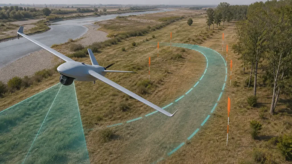
drone fixed wing obstacle avoidance lidar is one of the easiest phrases in UAV marketing to overstate. A fixed-wing aircraft can carry a LiDAR payload, detect terrain, and even use a rangefinder during landing-related tasks, while still lacking any true onboard logic that can autonomously avoid a pole, tree line, or narrow corridor in fixed-wing flight.
That gap matters for integrators and buyers. If a team wants to claim real-time avoidance, it has to prove more than sensor presence. It needs to prove controller authority, directional coverage, maneuver room, and a repeatable flight workflow that turns detection into a safe path change.
| Quick answer | Approve drone fixed wing obstacle avoidance lidar only after you verify that the sensor stack, flight stack, and turning geometry together can support an actual avoidance action, not just detection, terrain reference, or landing assistance. |
|---|---|
| Best fit | Fixed-wing UAV integrators, autonomy engineers, and technical buyers evaluating whether a LiDAR-equipped aircraft can genuinely support obstacle avoidance in corridor, inspection, or terrain-sensitive missions. |
| Main risk | Announcing obstacle avoidance because a LiDAR is installed, while the autopilot only supports terrain following, landing aid, or multicopter-only collision prevention. |
Why fixed-wing avoidance claims fail
The biggest trap is assuming that multirotor logic carries over to fixed-wing aircraft. Current ArduPilot Plane object-avoidance documentation says Plane only supports ADSB avoidance on the object-avoidance page. On the current PX4 side, collision prevention is documented for multicopters and VTOL vehicles in multicopter mode, not for ordinary fixed-wing flight. That means a fixed-wing UAV may absolutely carry LiDAR hardware without having native flight-controller behavior that can slow, stop, or reroute like a multirotor.
A second trap is confusing terrain following with obstacle avoidance. ArduPilot Plane terrain following supports fixed-wing terrain following through a terrain database and waypoint logic, which is useful for hills, return paths, and altitude-over-ground planning. But terrain following is not the same as dynamically avoiding a wire span, tree line edge, or pop-up obstacle near a bend. Terrain data helps you fly over modeled ground. Obstacle avoidance needs real-time scene interpretation plus enough authority to maneuver around a discrete hazard.
This is why fixed-wing buyers need a tighter checklist than general drone sensing articles usually provide. Purpleriver already covers broader drone obstacle-avoidance requirements, forward obstacle sensing, solid-state versus mechanical LiDAR, and core LiDAR terms. This article focuses on the fixed-wing systems question: what must exist before detection becomes real avoidance?
| Question | What sensor presence proves | What real avoidance proof still requires |
|---|---|---|
| Can the aircraft detect distance ahead or below? | A LiDAR or rangefinder can provide range data or a depth view. | Whether the aircraft can convert that information into a safe flight path in fixed-wing mode. |
| Can the autopilot avoid obstacles on its own? | Not necessarily. On current mainstream open stacks, fixed-wing support is more limited than multirotor support. | A documented avoidance pipeline, companion-computer logic, and flight-tested authority over lateral path changes. |
| Does terrain following solve this? | It helps maintain altitude relative to terrain data or approach logic. | It does not prove avoidance of poles, branches, wires, or tight corridor boundaries. |
| Is forward detection enough? | It may show an obstacle exists. | You still need side coverage, path-planning logic, and enough turn radius to avoid the obstacle in time. |
| Is the system ready for a customer claim? | No, not from hardware installation alone. | Only after sensor coverage, controller authority, maneuver geometry, and evidence logs all support the claim. |
What the MRP-LD1 facts mean for fixed-wing work
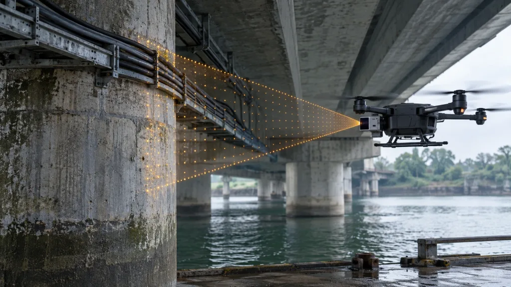
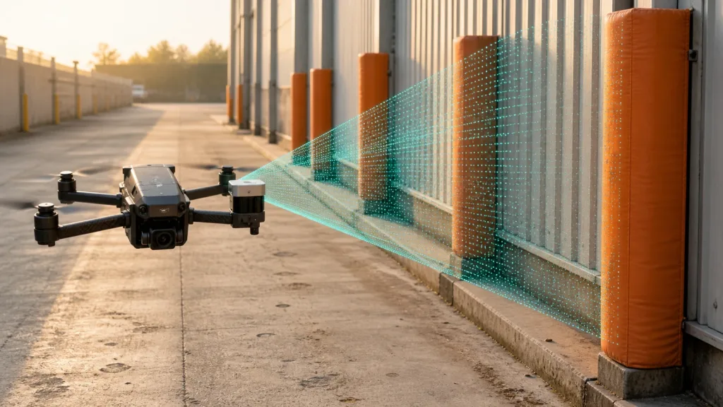
The Featured MRP-LD1 gives a compact dToF baseline: SPAD sensing, 940 nm VCSEL illumination, 60 degrees by 45 degrees field of view, 40 x 30 output at 10 fps, 5 V supply, 1.2 W power, 8 g weight, and UART, UVC, and UDP interfaces. Those are meaningful strengths for an experimental fixed-wing sensing package, but they do not override the control-law and geometry questions that fixed-wing teams must answer.
| Verified product fact | What it can support | What it does not prove by itself |
|---|---|---|
| Solid-state dToF with SPAD and 940 nm VCSEL | A lightweight active sensing path suitable for compact airframes and evaluation rigs. | That the fixed-wing aircraft has a native avoidance controller in the intended flight mode. |
| 40 x 30 at 10 fps | Enough structure for prototype perception tests beyond a single scalar range value. | That the companion stack can make safe turn decisions at the aircraft's actual speed and bank limits. |
| 60 degrees x 45 degrees field of view | A practical sector for forward or downward evaluation, depending on mounting. | That the field of regard covers every direction needed during a fixed-wing pass through a bend or corridor. |
| Indoor 0.5-25 m and outdoor 0.2-8 m range | Useful near-to-mid-range sensing for close inspection experiments and slow validation passes. | That the aircraft has enough time and lateral room to react at mission speed once an obstacle is detected. |
| UART, UVC, and UDP interfaces | Multiple integration paths for a flight controller, companion computer, or lab recorder. Purpleriver's interface guide helps frame those tradeoffs. | That the chosen path preserves deterministic timing and logs rich enough for post-flight analysis. |
| 8 g weight and 1.2 W power | A low payload penalty for a small fixed-wing test bed. | That the sensor can be mounted with a clear forward view free of prop blur, fuselage masking, or vibration contamination. |
A realistic corridor case
Imagine a small fixed-wing UAV inspecting a river corridor bordered by sparse trees, utility poles, and a gradual bend in the route. The aircraft does not need to stop like a multirotor. It needs enough forward awareness, enough lateral clearance, and enough controller authority to choose or maintain a safe path before the obstacle geometry closes in.
This is where many weak demos collapse. A bench test might show a nice forward depth sector. A straight-line pass might show that the LiDAR sees a pylon. But the harder question is whether the aircraft can still clear the obstacle once you account for turn radius, current airspeed, bank-angle limits, and missing side coverage. If the system only detects the object once it is too late to maneuver, the payload is interesting but the avoidance claim is still false.
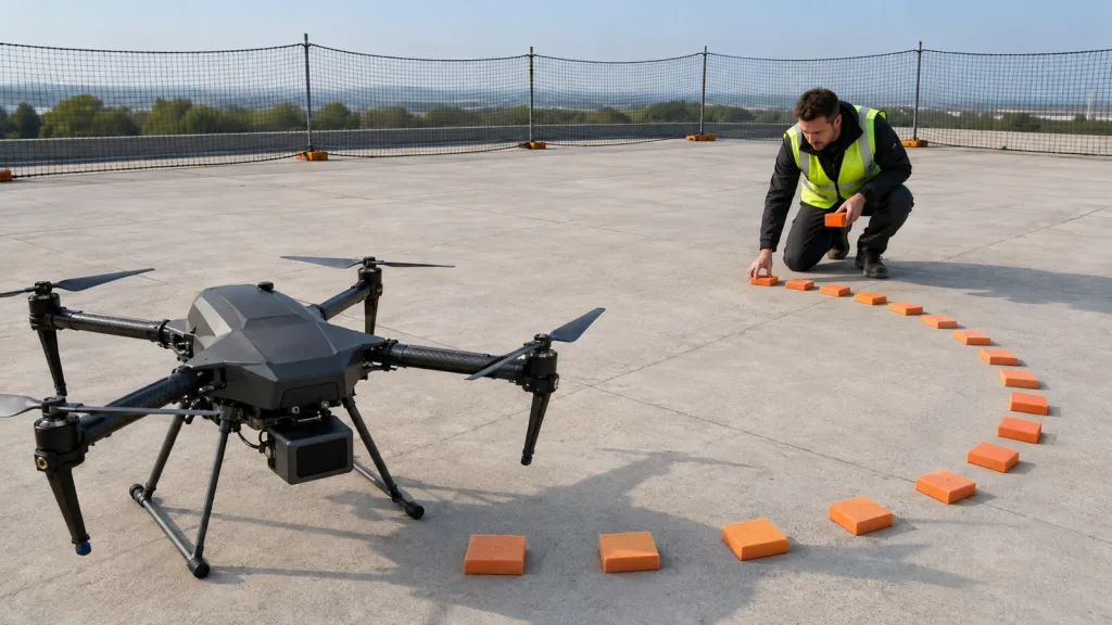
For that reason, the first fixed-wing validation route should include more than a straight obstacle encounter. It should include a marked gap, a lateral offset target, and at least one bend where the team can observe whether the sensing stack gives enough early information for a safe maneuver rather than a late warning.
Flight-stack authority and integration path
How drone fixed wing obstacle avoidance lidar should be validated
Start by identifying where avoidance authority actually lives. If the fixed-wing autopilot mode does not natively perform rangefinder-based obstacle avoidance, then the missing function must come from a companion computer, offboard planner, or a different vehicle architecture. That distinction should appear in the requirements document before a single flight claim is made.
ArduPilot Plane's current documentation is particularly useful here because it narrows what a rangefinder does in fixed-wing modes. The current Plane altitude documentation limits rangefinder use in fixed-wing flight to cases such as adjusting glide slope during automatic landings and determining certain altitude-dependent events. That is useful, but it is not the same as saying a fixed-wing aircraft can autonomously steer around obstacles because a LiDAR is installed.
PX4 helps frame the other half of the problem. Its current collision-prevention documentation warns that the feature applies to multicopters and VTOL in multicopter mode, and that enabled directions require sensor coverage in those directions. That is exactly the fixed-wing design lesson: even if you build an offboard avoidance stack, you still have to verify field of regard, timing, and the path authority to use that data safely. The current PX4 rangefinder documentation is also useful because it separates supported distance-sensor hardware from the broader autonomy stack that must consume it safely.
For evidence capture, log more than point detections. Record the sensor stream, airspeed, commanded path, bank angle, avoidance trigger condition, and whether the commanded maneuver stayed inside the planned safe corridor. Without that evidence, a flight team cannot separate a perception limit from an airframe-maneuver limit.
Common mistakes
- Claiming obstacle avoidance because the airframe carries LiDAR, without confirming that fixed-wing flight modes actually use that data for path changes.
- Confusing terrain following, autoland range aid, or altitude reference with real-time discrete-obstacle avoidance.
- Validating only straight-ahead detection while ignoring side coverage and the extra space a fixed-wing aircraft needs to turn away safely.
- Testing at a speed or bank limit that leaves no maneuver margin once an obstacle is detected.
- Logging detections but not the commanded path response, which makes it impossible to prove that the system performed avoidance rather than simple sensing.
RFQ and validation checklist
| Checkpoint | What to record | Pass condition |
|---|---|---|
| Authority path | Which controller, companion stack, or planner is responsible for avoidance action. | The team can point to one documented component that actually owns the maneuver decision. |
| Field of regard | Forward and side coverage from the installed sensor location. | Coverage matches the directions needed for the intended corridor or route geometry. |
| Turn geometry | Minimum safe speed, bank-angle limits, and corridor width assumptions. | The aircraft has enough room to execute the commanded avoidance path after detection. |
| Obstacle route test | Marked gap pass, lateral-offset target, and one bend or narrowing section. | The aircraft demonstrates repeatable safe path behavior, not just awareness of an object ahead. |
| Data and replay | Sensor stream, path command, airspeed, and attitude logs. | The team can replay exactly why a maneuver succeeded or failed. |
| Procurement claim | Final statement of what the airframe can and cannot do today. | The claim distinguishes clearly between detection, terrain following, landing aid, and true obstacle avoidance. |
What to ask before the next fixed-wing pilot program
If your team wants to evaluate a LiDAR-equipped fixed-wing UAV, ask one direct question before requesting the next sample or pilot build: where does the avoidance decision actually happen? If the answer is vague, the program is not ready to claim obstacle avoidance yet.
Use Purpleriver's MRP-LD1 product page as the verified product-fact source, then define the airspeed, turn-radius, coverage, and logging requirements that a real fixed-wing avoidance demonstration must satisfy.
Technical guide
FAQ
Common questions and practical answers from this technical guide.
Can a fixed-wing UAV carry LiDAR without having real obstacle avoidance?
Yes. Sensor installation alone does not prove that the aircraft can autonomously change path safely in fixed-wing flight.
Why is fixed-wing obstacle avoidance harder than multirotor avoidance?
Because fixed-wing aircraft cannot simply stop and hover. They need maneuver room, path authority, and enough time to turn clear of an obstacle.
Does terrain following count as obstacle avoidance?
No. Terrain following helps maintain altitude relative to the ground or terrain database. It does not by itself avoid discrete hazards such as poles, wires, or corridor boundaries.
What do current open autopilot docs imply for fixed-wing buyers?
They imply that buyers must check actual feature scope very carefully. Current ArduPilot Plane and PX4 documentation do not support the assumption that fixed-wing obstacle avoidance works the same way as multicopter collision prevention.
Can a companion computer close the feature gap?
Potentially yes, but only if the full stack is validated. A companion computer may provide perception and planning, yet the aircraft still needs enough control authority and maneuver room to execute the plan.
Is forward detection enough for a fixed-wing avoidance claim?
No. Side coverage and path geometry matter because a fixed-wing aircraft often needs room to turn around an obstacle rather than merely detect it ahead.
What is the first useful test route?
A better first route is a marked corridor with a lateral offset, a gap, and at least one bend. That exposes the difference between seeing an obstacle and actually clearing it.
What is the best procurement output from an evaluation campaign?
A precise capability statement that separates sensing, landing aid, terrain following, and proven obstacle avoidance. Buyers should reject any report that collapses those into one vague promise.