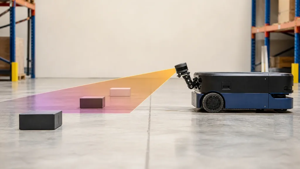
AGV AMR navigation LiDAR becomes useful only after a robotics team proves that the sensor data can survive the whole navigation chain: scan or point-cloud input, transform alignment, costmap behavior, and the ugly aisle geometry that shows up in a real pilot route. A compact LiDAR module is not approved because it made one RViz screenshot look clean. It is approved because the team can explain what the robot saw, what the navigation stack consumed, and why the route stayed understandable at shelf legs, pallet edges, and turning pockets.
This guide is written for warehouse automation leads, robotics integration engineers, and technical buyers who need a practical proof plan before they commit to a pilot aisle, a first customer site, or a wider AGV/AMR rollout.
| Quick answer | Validate AGV AMR navigation LiDAR by proving four things together: correct frame alignment, stable costmap inputs, enough scene coverage at aisle ends and shelf legs, and a replay path that preserves weak runs instead of hiding them behind one successful demo. |
|---|---|
| Best fit | AGV and AMR teams evaluating compact solid-state LiDAR for warehouse navigation, obstacle avoidance, SLAM, and pilot-route risk review. |
| Decision rule | If the team cannot explain the route with synchronized sensor data, transforms, and costmap behavior, the module is not ready for a live pilot aisle. |
Why AGV AMR navigation LiDAR must be validated as a stack, not a component
Current Nav2 documentation is a good reminder that navigation success is not decided by the sensor alone. The mapping and localization guide ties robot navigation to scan topics, map and localization flows, and costmap layers that consume either LaserScan or PointCloud2. The same guide also makes the transform chain explicit: a navigation proof needs the robot state publisher and the required transforms, including the map => odom relationship, before the costmaps and route review become meaningful.
That is why a robotics team should judge an AGV AMR navigation LiDAR setup as a full stack. A route can fail because the LiDAR lacks the right coverage, because the transform tree is wrong, because the update rate is stale, or because the costmap is flattening useful evidence too early. All of those failures look similar to a non-specialist watching a robot hesitate in an aisle. They are not the same engineering problem.
If you need the broader robotics context first, start with LiDAR for Robotics and robotics mapping LiDAR for AMR and service robot navigation. This article starts one step later: proving whether an AGV AMR navigation LiDAR workflow is strong enough for a pilot route in the first place.
AGV AMR navigation LiDAR stack checks come before route tuning
Nav2's obstacle and voxel layers can consume either LaserScan or PointCloud2 inputs, and the obstacle layer documentation exposes the practical tuning hooks that often matter during a pilot: sensor frame, expected update rate, observation persistence, and the height and range limits that control what is inserted into the occupancy grid. In plain deployment terms, that means the real acceptance test is not "did the robot avoid one box?" It is "can the team explain what data entered the planner, when it entered, and which frame it belonged to when the robot made a navigation decision?"
Decision matrix for pilot-route readiness
| Evaluation area | What to verify | Why it matters | Reject if |
|---|---|---|---|
| Frame alignment | Whether the LiDAR data stays correctly related to base_link, odom, and map during replay |
Navigation debugging breaks down if the robot cannot explain where the data belongs | The team sees route drift or obstacle jumps but cannot identify the frame path |
| Costmap input choice | Whether the pilot should start with LaserScan, preserve PointCloud2, or use both |
Flattening the wrong data too early can hide weak geometry | The team does not know what the planner actually consumed |
| Aisle-end coverage | How well shelf legs, pallet corners, fork pockets, and route-turn pockets stay visible | Pilot routes usually fail at the edges and transitions, not in open floor space | Validation uses only wide-open straight runs |
| Update discipline | Expected update rate, observation persistence, and stale-data behavior | Old data can be as dangerous as missing data in a navigation proof | The robot reacts to obstacles but the log cannot show whether the input was fresh |
| Replayability | Whether weak runs can be reviewed with synchronized sensor, transform, and route evidence | One live demo is not enough to approve a pilot | The team can describe the problem but not replay it |
Exact featured-product parameters to screen
The current Featured product is the LiDAR Drone Module - MRP-LD1 Solid-State dToF Sensor. The product export explicitly includes robot navigation, obstacle avoidance, and SLAM in its approved application scope. That makes it a valid factual basis for an AGV/AMR pilot guide, provided the article stays honest about what must still be validated in the navigation stack.
| Parameter | Published value | Validation implication |
|---|---|---|
| Ranging principle | dTOF | Plan to validate distance behavior in motion, not only static bench scenes. |
| Scanning principle | SPAD | Treat sensitivity claims as a reason to review weak aisle geometry more carefully. |
| Emitter | 940nm VCSEL | Include reflective packaging, mixed surfaces, and warehouse lighting in the proof plan. |
| Laser safety | Class 1 | Useful for screening, while the deployed robot cell still needs its own safety review. |
| Range | Indoor 0.5-25m; outdoor 0.2-8m | For AGV or AMR use, judge the realistic aisle and turn geometry instead of the maximum headline. |
| Ambient-light resistance | 80Klux | Bright loading-bay spill or mixed-light zones still belong in the test set. |
| Accuracy | 0.2-1m <= +/-3cm; 1-5m <= +/-5cm; 5-8m <= +/-10cm; 8-15m <= +/-20cm | Translate each band into route clearance, docking margin, and slow-speed stop distance rules. |
| Field of view | 60 degrees (H) x 45 degrees (V) | Map the visible corridor against shelf legs, pallet edges, and turn pockets before pilot approval. |
| Resolution / frame rate | 40 x 30 at 10fps | Useful for compact navigation review if the team defines what evidence the route actually needs. |
| Interfaces | UART / UVC / UDP | Pick the route that gets you replayable evidence first, then optimize. |
| Software support | Windows / ARM / Linux / Android | Helpful when the bench logger, robot controller, and review workstation differ. |
| Power / weight | 5V, 1.2W, 8g | Important for compact robot masts or embedded brackets, but still secondary to route proof. |
Validation workflow before a pilot route
1. Define the pilot route and failure geometry first
Write down the route section that matters: a pallet-rack aisle, a fork-pocket entry, a charging approach, or a mixed open-floor to narrow-turn transition. Then list the weak geometry that should be visible in the first proof run, such as shelf legs, pallet overhang, corner protectors, or reflective wrap. If the team does not define the route geometry first, it will spend days discussing maps and filters without knowing what the sensor actually needed to preserve.
2. Prove the transform chain before blaming the map
ROS tf2 exists to manage the relationship between source and target frames. In practice that means your LiDAR evidence has to stay attached to the right frame relationships during replay. Before tuning localization or costmaps, confirm that the robot can show a stable relationship from the sensor to the robot body and from the robot body into the navigation stack's route context. If shelf legs appear to jump or drift between runs, a transform problem may be hiding inside what looks like a mapping problem.
3. Choose the simplest costmap input that still preserves useful evidence
Nav2 supports obstacle-layer and voxel-layer inputs from LaserScan and PointCloud2. A compact pilot usually wants the simplest stable path first, but not at the cost of destroying the evidence you need later. If the team only needs a reliable 2D route check, a scan-first approach may be enough. If it still needs to inspect weak geometry or height-related ambiguities, preserve PointCloud2 evidence instead of flattening everything too early. The point-cloud evaluation guide at how to evaluate a LiDAR point cloud dataset before integration is the right internal companion for that decision.
4. Test update discipline under route motion
Nav2's obstacle-layer documentation exposes parameters such as expected update rate, observation persistence, sensor frame, and range constraints because they affect whether the planner is operating on current reality or stale history. For a warehouse pilot, that means the robot should not only avoid a visible object once. It should show that obstacle observations arrive at the expected cadence, clear correctly, and remain explainable when the robot transitions from a straight aisle to a turn pocket.
5. Force aisle-end and shelf-leg checks into the first run
Open-floor demos are easy. The valuable run is the one that tests the geometry that creates real hesitation later: shelf legs, pallet corners, route-end turns, or side-obstacle clutter near a docking zone. Validate those before the team starts tuning the path planner. If the route proof is weak there, planner tuning will only disguise the missing sensor evidence for a while.
6. Freeze reject conditions before expansion
Reject the setup if the team cannot replay weak runs, if it does not know which topic the navigation stack consumed, if transform alignment is still uncertain, or if route success depends on ignoring the very aisle features that matter operationally. Those are not minor configuration tasks; they are proof failures.
Interface, data, and integration planning
An AGV AMR navigation LiDAR project becomes expensive when the mechanical, perception, and navigation owners are not looking at the same evidence. Keep the handoff explicit from day one.
| Integration topic | Questions to answer before route expansion |
|---|---|
| Sensor topic | Which topic is the planner actually consuming, and does it match the team's intended proof path? |
| Frame ownership | Who verifies the sensor frame, base_link, and route-level transforms after each mounting or software change? |
| Data form | Will the team review LaserScan, preserve PointCloud2, or keep both during the first pilot? |
| Update behavior | What update cadence is expected, and how will stale or dropped observations be detected during replay? |
| Coverage sketch | Which aisle features must stay in the visible corridor for the route to remain safe and understandable? |
| Escalation path | When the route fails, does the next step belong to transforms, sensor placement, costmap settings, or downstream planner tuning? |
The most useful internal support pages for this stage are common LiDAR integration issues, UART, UVC, or UDP, and documentation resources. They help the team get to replayable evidence without confusing interface bring-up with navigation approval.
Realistic application case: validating a pallet-rack aisle with narrow end-turn geometry
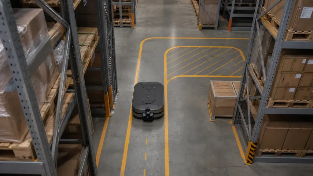
Consider an AMR that must run a short warehouse route between pallet racks, pause near a side pallet, and then turn into a narrow end pocket before returning. The mission is not full-fleet deployment. It is a pilot proof that the robot can keep the critical aisle features visible and understandable to the navigation stack.
- Bench-capture one clean straight run and one cluttered run using the intended LiDAR interface path.
- Replay both runs while confirming that the transform chain remains stable from sensor to robot body and route context.
- Drive the pilot route with shelf legs, pallet corners, and the end-turn pocket included in the first pass.
- Confirm whether the costmap saw fresh observations at the expected cadence and cleared them correctly when the robot moved past obstacles.
- Approve wider testing only if the team can explain the route outcome with synchronized sensor data, costmap behavior, and transforms.
This is a useful acceptance pattern because it tests the operational question that matters most: whether the AGV or AMR can navigate real aisle geometry with evidence that survives replay and review.
Common mistakes when validating AGV AMR navigation LiDAR
- Judging the module from one clean RViz view instead of a replayable pilot route.
- Tuning planners before verifying the transform chain and input topic.
- Flattening all data to 2D before checking whether richer point-cloud evidence is still needed.
- Validating only open-floor motion instead of shelf legs, pallet corners, and route-end turns.
- Ignoring update cadence and observation persistence until the robot hesitates in front of a stale obstacle.
- Blaming SLAM or localization before checking whether the LiDAR coverage and costmap inputs were already weak.
RFQ and engineering checklist
| Checklist item | Why it belongs in the approval sheet |
|---|---|
| Pilot route definition | Keeps the proof tied to real warehouse geometry rather than generic demos. |
| Critical aisle features list | Forces shelf legs, pallet corners, and turn pockets into the first meaningful run. |
| Sensor topic and data type | Confirms what the navigation stack is truly consuming. |
| Transform owner | Prevents frame confusion from being discovered only after route failure. |
| Update-rate expectation | Makes stale-data problems visible during replay. |
| Replay package | Ensures weak runs can be reviewed by the whole team after the test. |
| Reject conditions | Stops pilot expansion while route evidence is still ambiguous. |
| Vendor support packet | Lets the next discussion start with real route geometry, stack assumptions, and evidence gaps. |
Approve the route evidence before you expand the fleet
A compact solid-state LiDAR is ready for an AGV or AMR pilot only when your team can explain the route through synchronized sensor data, stable transforms, and costmap behavior that still makes sense at the weak geometry of a real aisle.
- Bring your pilot-route sketch, transform assumptions, and current sensor topics to the review instead of asking for a generic navigation demo.
- Use the MRP-LD1 product page, documentation resources, and point-cloud evaluation workflow to get to replayable evidence faster.
Purpleriver, founded in 2015, develops solid-state dToF LiDAR technology for robotics perception, UAV, and industrial depth-sensing workflows.
Contact Purpleriver with your aisle geometry, route constraints, preferred interface path, and navigation-stack assumptions if you want to align module fit before a pilot deployment.