3D point cloud sensor projects often go wrong before the team has written a single segmentation script. The real failure point is usually earlier: a compact sensor is mounted, a live viewer shows “something,” and everyone starts debating software before anyone has proved frame alignment, usable scene coverage, or a replay path for weak data.
This guide is written for robotics integration leads, mapping engineers, and technical buyers who need a practical way to judge whether a compact depth sensor can hand off mapping-ready point-cloud data before they commit to a larger processing stack.
| Quick answer | Approve a 3D point cloud sensor only after you verify frame integrity, replayable logging, scene coverage, and a clear handoff dataset that the software team can process consistently. |
|---|---|
| Best fit | Compact AMR, service-robot, and early mapping programs that need practical point-cloud evidence before choosing filters, segmentation tools, or downstream mapping software. |
| Decision rule | If the team cannot explain which frame owns the cloud, which scenes represent pass or fail, and how weak runs will be replayed later, the sensor is not ready for broader integration. |
Why mapping teams misjudge early point-cloud readiness
A point cloud becomes useful only when the data can be placed, replayed, and compared consistently. ROS documentation describes tf2 as the transform library that keeps track of multiple coordinate frames over time, and the official sensor_msgs/PointCloud2 message definition treats a cloud as a structured collection of points that may also carry fields such as intensity or normals. In practical terms, that means a visible cloud in a viewer is not the same thing as mapping-ready data. The team still has to prove frame ownership, time consistency, and usable output fields.
The processing side matters too. Point Cloud Library documentation highlights common operations such as filtering, segmentation, registration, feature extraction, and surface reconstruction. That is exactly why early approval needs discipline: if the raw handoff is unstable, the software team will waste time arguing over tools instead of fixing the upstream data path.
NIST's point-cloud evaluation work is the right mindset for this stage because it emphasizes quantifiable comparison instead of impressionistic demos. For a buyer or integration lead, the practical translation is simple: define what counts as a good cloud, a weak cloud, and a failed handoff before you start shopping for processing software.
3D point cloud sensor decision chart
| Decision area | What to verify | Why it matters | Reject if |
|---|---|---|---|
| Frame integrity | Sensor frame, robot frame, and map frame ownership; timestamp consistency; replay behavior | A point cloud that cannot be placed consistently will poison every downstream map and comparison step | The team cannot explain how a saved cloud reaches the same pose interpretation twice |
| Coverage fit | Mounting angle, blind spots, expected stand-off distance, aisle or obstacle geometry | Good processing cannot recover scene regions the sensor never captured well | The useful scene falls outside the reliable sensing cone |
| Replayable evidence | Logged runs, weak-scene examples, repeatable bench or aisle captures | Software decisions should come from comparable data, not one live demo | No one can revisit bad runs after the first test window closes |
| Output usefulness | Depth grid, point-cloud export, fields available for review, noise level, confidence handling | Processing effort depends on what the sensor actually hands over | The software team must infer critical metadata or rebuild missing context by hand |
| Program fit | Power, weight, interface path, host support, and documentation maturity | Compact mapping projects fail when a proof sensor creates unnecessary bring-up drag | The shortest path to a logged dataset is still fragile or undocumented |
Exact featured-product parameters to screen
The current Featured product available for this workflow is the LiDAR Drone Module - MRP-LD1 Solid-State dToF Sensor. It is a sensible example for early point-cloud planning because the published description explicitly includes real-time depth images and 3D point-cloud data, while remaining small enough for compact robotics and UAV programs.
| Parameter | Published value | Handoff implication |
|---|---|---|
| Ranging principle | dTOF | Expect the review path to start from depth-oriented measurements, not only RGB-style inspection. |
| Scanning principle | SPAD | Treat output stability and scene evidence as the validation target, not the detector term alone. |
| Emitter | 940nm VCSEL | Window material, reflectivity, and ambient-light conditions belong in the test plan. |
| Laser safety | Class 1 (FDA Recognized Eye-Safe) | Useful screening context, while the final integrated system still needs its own safety review. |
| Range | Indoor 0.5-25m; outdoor 0.2-8m | Translate the usable band into your real mapping aisle, corridor, or approach geometry. |
| Ambient-light resistance | 80Klux | Bright spill, doors, windows, and reflective surfaces still need direct testing. |
| Accuracy | 0.2-1m <= +/-3cm; 1-5m <= +/-5cm; 5-8m <= +/-10cm; 8-15m <= +/-20cm | Map these bands to your acceptance tolerances before any software benchmarking. |
| FoV | 60 degrees (H) x 45 degrees (V) | Model the sensing cone against the real aisle or obstacle geometry, not an abstract rectangle. |
| Resolution / frame rate | 40 x 30 at 10fps | This is often enough for early replay and mapping handoff if the downstream team expects a compact cloud, not dense survey data. |
| Interfaces | UART / UVC / UDP | Choose the first interface that gets you to repeatable saved runs fastest. |
| Software support | Windows / ARM / Linux / Android | Useful when bench logging and eventual embedded integration happen on different hosts. |
| Power / weight | 5V, 1.2W, 8g | Supports compact integration studies without turning the sensor into a payload problem first. |
Validation workflow before software selection
1. Define the handoff dataset before you debate processing tools
Several public user questions circle around the same mistake: teams ask which point-cloud software to buy before they have a repeatable dataset to compare. Start with a plain approval sheet: scene geometry, mounting pose, expected stand-off distance, frame names, logging path, and two or three weak-scene captures that everyone agrees matter.
2. Prove that the cloud belongs to the right frame at the right time
If the sensor frame, robot base, and map frame are not stable, the cloud may look acceptable in a viewer while still failing in replay or map fusion. This is why transform handling belongs in the first validation loop. Record one known route twice and confirm that the same scene produces the same placement logic when replayed. If your team cannot explain a pose jump, do not move downstream to segmentation yet.
3. Use the fastest route to replayable data
The MRP-LD1 supports UART, UVC, and UDP. For early evaluation, the best first path is usually the one that gets you a saved run with the least friction, not the one that looks architecturally elegant. Purpleriver's documentation hub, sample datasets, and the article on visualizing dToF depth data for early product testing are the right internal support materials for that stage.
4. Separate coverage problems from processing problems
If the mounting angle misses shelf edges, wheel-clearance zones, or aisle ends, no amount of filtering will fix that. Before you compare segmentation or registration workflows, verify that the sensor actually sees the parts of the environment the map needs. This is where coverage drawings and simple replay clips outperform software debates.
5. Review weak data before approving stronger scenarios
Reddit-style user concerns repeatedly point to the same pain: rough point clouds look acceptable until someone tries to classify, align, or compare them later. Log the weak cases first, such as reflective guards, bright doorways, or long uniform walls. If the saved run cannot support a useful engineering conversation, the sensor handoff is not mature enough for a full software evaluation.
Interface, data, and frame-handoff planning
A `3D point cloud sensor` is easiest to approve when the robotics team and software team share the same handoff checklist. This table keeps the first pass concrete.
| Integration topic | Questions to answer before wider adoption |
|---|---|
| Frame ownership | Which frame names identify the sensor, robot body, and map, and who verifies their consistency during replay? |
| Saved evidence | Can the team replay the exact weak scene that triggered concern, or only remember it from a live run? |
| Data form | Will the first review use raw depth, compact point clouds, or both, and which fields are preserved? |
| Coverage model | Has the FoV been mapped against real aisle width, object height, and expected turns? |
| Host workflow | Does the first proof run happen on Linux, Windows, or ARM, and can the same data be reviewed later by the software owner? |
| Escalation rule | When a cloud looks bad, can the team tell whether the next step is remounting, transform repair, interface cleanup, or downstream filtering? |
For the next stage after handoff validation, use Purpleriver's guide on how to evaluate a LiDAR point cloud dataset before integration, the mapping primer on robotics mapping LiDAR for AMR and service robot navigation, and the troubleshooting article on common LiDAR integration issues and how to diagnose them.
Realistic application case: compact AMR aisle mapping with replay-based review
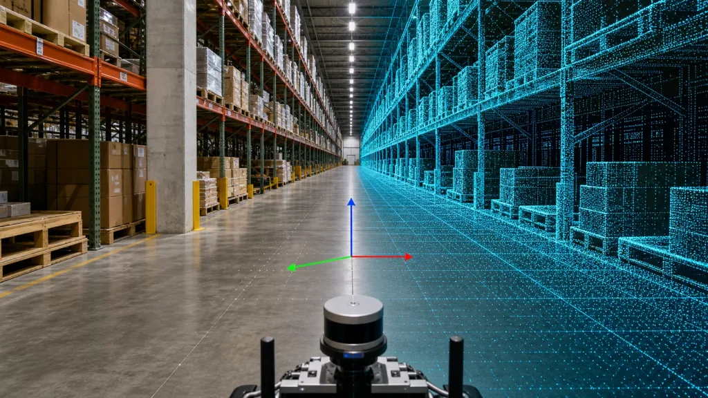
Consider a small warehouse AMR that needs to map a service aisle before the software team decides how much filtering and registration effort is acceptable. The robot does not need a perfect survey model on day one. It needs a repeatable point-cloud handoff that shows aisle edges, pallet corners, guard rails, and turn geometry consistently enough for replay and comparison.
- Mount the compact sensor at the planned height and pitch, then drive one known aisle loop twice.
- Save the runs with the frame context intact so the same route can be replayed later.
- Compare where edge dropouts, wall thickening, or pose jumps happen in the same physical locations.
- Confirm whether the weak areas are caused by scene coverage, transform logic, or downstream interpretation.
- Approve the sensor for broader software evaluation only if the team can explain both the clean and weak sections from saved evidence.
This keeps the decision realistic. It tests whether the sensor can hand over usable mapping data, not whether a single live visualization looked promising for two minutes.
Common mistakes when reviewing a point-cloud handoff
- Choosing processing software before defining the saved dataset and pass or fail scenes.
- Treating a visible live cloud as proof that frame alignment is correct.
- Using only easy straight-wall scenes and postponing reflective or cluttered zones.
- Blaming downstream software for blind spots created by mounting geometry.
- Ignoring which point fields are preserved in the handoff.
- Saving only successful runs and none of the weak evidence that matters most later.
RFQ and engineering checklist
| Checklist item | Why it belongs in the approval sheet |
|---|---|
| Named frames and replay owner | Prevents transform problems from being discovered after software time is already committed. |
| Target aisle or obstacle geometry | Keeps coverage review tied to the real mapping task. |
| Preferred first interface | Reduces time to the first repeatable saved run. |
| Weak-scene capture list | Forces the evaluation to include the runs that matter most later. |
| Point-cloud fields required downstream | Clarifies whether the software team has enough information to compare runs meaningfully. |
| Host and replay workflow | Keeps bench logging, software review, and embedded planning aligned. |
| Coverage sketch against FoV | Separates geometry mistakes from software complaints. |
| Escalation path | Shows whether a bad run belongs to mechanics, transforms, transport, or downstream processing. |
Approve the handoff before you optimize the stack
If your team can save weak runs, explain frame ownership, and compare the same route twice with confidence, a compact point-cloud sensor is ready for deeper software evaluation. If those answers are still vague, tighten the handoff workflow before you spend more processing effort.
- Share the real scene geometry, frame plan, and replay expectations instead of asking for a generic live demo.
- Use Purpleriver's documentation, sample datasets, and product page to shape an evaluation path that produces comparable evidence.
Purpleriver, founded in 2015, develops solid-state dToF LiDAR technology and supports compact depth-sensing evaluation workflows around the MRP-LD1 module.
Contact Purpleriver with your mapping handoff requirements if you want to align scene geometry, interface choice, and replay criteria before a full integration cycle.