10fps 3D Point Cloud LiDAR Sensor: A Capture-to-Archive Acceptance Plan
A 10fps 3D point cloud LiDAR sensor can make a promising evaluation candidate, but an attractive live view is not yet a usable engineering record. Before a team tunes mapping, classification, or motion behavior, it should be able to answer four plain questions: what did the sensor deliver, when was each capture made, how was the geometry described, and can another reviewer reopen the same evidence?
This guide gives embedded-perception teams a narrow acceptance plan for that first handoff. It does not promise a navigation, mapping, or obstacle-avoidance outcome. It helps a team preserve raw evidence, describe one deliberate conversion path, and decide whether the next experiment is warranted.
Quick answer
Use a capture-to-archive package rather than a screenshot: retain the original output, create a capture manifest, document the scene and mounting, identify any derivative processing, and replay a small set of ordinary and imperfect records. The available MRP-LD1 Drone LiDAR Sensor is documented with 40 × 30 resolution, 10 fps, depth and 3D point-cloud output, and UART/UVC/UDP interfaces. Those facts are a starting point for an evaluation; they do not establish application performance.
- Choose one output mode and one transport for the first evidence package.
- Keep the original capture and record its mode, conditions, and capture window.
- Write down frame/point fields, units, coordinate convention, and any validity rule.
- Label every filtered, reduced, or converted file as a derivative of a named original.
- Review normal, sparse, and interrupted captures before connecting a downstream decision.
1. A 10fps 3D point cloud LiDAR sensor needs an acceptance boundary
Ten frames per second describes a sensor-output cadence. It does not tell a reviewer whether a host received every intended record, whether an export retained the needed fields, whether the geometry has a known reference frame, or whether a downstream application interpreted unavailable data safely. Treat cadence as something to observe and document in the selected setup—not as a shortcut to an application claim.
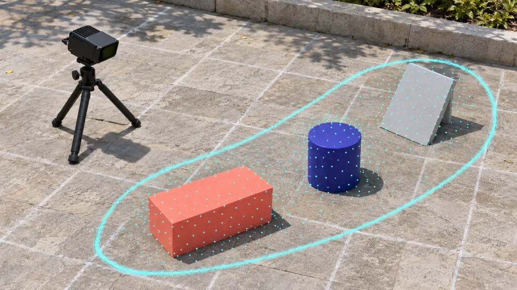
A useful first boundary is deliberately modest: one mounted sensor, one selected output mode, one host and transport, a named capture interval, and a replayable package. The package should let a colleague distinguish an original record from a visualization or derivative. It should also identify what the project has not established yet: coverage, range in a particular scene, data quality for a model, and every behavior that depends on the host application.
For vocabulary around the outputs, compare the site’s depth-map and point-cloud explanation. For a broader inspection approach, see how to evaluate a LiDAR point-cloud dataset before integration. This article concentrates on the handoff record that comes before either representation is trusted by a larger workflow.
2. Use a capture-to-archive decision table
The table turns a short trial into evidence a buyer, integrator, or later reviewer can actually inspect. It is an evaluation-planning aid, not a certification or a promise that the sensor will meet a particular application requirement.
| Acceptance layer | Record to retain | Question the record answers | What it does not prove |
|---|---|---|---|
| Source capture | Original sensor output, chosen mode, capture start/end, host identifier, and file integrity check. | Can the team identify the raw evidence and repeat the opening step? | It does not prove field coverage, accuracy, or final application behavior. |
| Scene sheet | Target geometry/material, approximate arrangement, mounting revision, ambient notes, and any motion during capture. | What physical conditions produced this record? | It does not generalize one scene to every surface or environment. |
| Data contract | Fields, units, coordinate convention, capture index/timestamp source, valid/invalid convention, and parser version. | Can a second engineer interpret the exported data without guessing? | It does not prove every consumer handles the data correctly. |
| Derivative ledger | Named original, tool/version, operation, parameters, and resulting file for each conversion or reduced cloud. | Can a reviewer trace a visual or model input back to its source? | It does not make a derivative more truthful than its source. |
| Review set | One ordinary scene and deliberately selected difficult or interrupted records, with observations and open questions. | What should the team investigate next? | It does not authorize automatic behavior or deployment. |
If an evaluator needs a smaller inspection copy, it should keep the original and declare the derivative. The Point Cloud Library’s VoxelGrid documentation shows one example of reducing a cloud with a voxelized grid and representative centroids. That is a processing option to record and review; it is not a universal setting or an MRP-LD1 performance claim.
3. Screen the documented MRP-LD1 facts before planning the file record
The following table separates published product information from project-owned evidence work. It uses only the available Featured-product export.
| Published field | Documented MRP-LD1 value | Responsible evaluation use |
|---|---|---|
| Product | MRP-LD1 Drone LiDAR Sensor | Use the current product page and requested materials as the product-fact source for the trial. |
| Sensing architecture | Solid-state SPAD dToF | Describe the evaluation candidate accurately; do not infer a complete host pipeline from the architecture. |
| Output | Depth images and 3D point-cloud data | Choose which output is the original record and define how the project will interpret it. |
| Resolution and rate | 40 × 30; 10 fps | Use them to set an observation window and expected capture bookkeeping, then inspect the actual selected mode. |
| Interfaces | UART, UVC, UDP | Select one first transport, name the reader, and record the protocol/SDK material used. |
| Listed host support | Windows, ARM, Linux, Android | Confirm the target environment and supplied materials; the listing does not specify a project parser or application. |
| Field of view | 60° × 45° | Record installed pose and occlusions in the chosen rig rather than making a coverage assumption. |
| Mass and supply/power | 8 g; 5 V; 1.2 W | Include the module in the project budget and separately account for selected mounting, cabling, and host hardware. |
| Published range/environment baseline | 0.5–25 m indoors; 0.2–8 m outdoors; 80 Klux ambient-light resistance | Note actual target, angle, illumination, and scene conditions; validate the intended use rather than extrapolating. |
The product record also lists robot navigation and obstacle avoidance, UAV obstacle avoidance and altitude hold, AR/VR auxiliary focusing, and industrial inspection/security as application groups. Those are suitable evaluation contexts, not evidence that a particular customer system is complete or approved.
4. Illustrative case: a moving-target capture station for a small inspection team
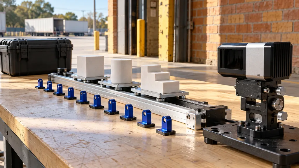
Consider a team preparing a compact inspection demonstrator. Instead of beginning with an algorithm claim, it builds a short capture station: the sensor is fixed to a rigid bracket, a small target sled moves through three repeatable positions, and the host captures the chosen output during a named interval. The team uses the same mounting revision for each comparison and writes down the target form, surface, lighting, and any motion.
For each run, the archive contains the original capture, a manifest, and a small rendered preview that is clearly marked as a preview. When the team creates a reduced inspection cloud, it stores a separate derivative with its source filename, tool, version, and parameters. A reviewer can now ask a useful question: “Does this visual come from this raw capture under these conditions?” rather than accepting a detached image.
One run deliberately includes a partial obstruction or interrupted stream. The desired outcome is not a claim that the system sees through every condition. It is an honest log of what was captured, what was missing, and how the project adapter reported the situation. That evidence tells the team whether the next step is parser work, a host test, a different scene, or a constrained perception experiment.
5. Make the interface and data handoff reviewable
For a 10fps 3D point cloud LiDAR sensor, record a source contract before a processing contract
Start with one documented transport—UART, UVC, or UDP—and one component that reads it. The project should record the selected output mode, protocol or SDK revision, host environment, frame/packet boundary, and parser revision. The site’s UART, UVC, or UDP guide can help frame the transport decision; the trial still needs its own evidence record.
Make each capture interpretable without a live viewer
A data manifest should name the original file and include a capture index or timestamp source, point fields, units, coordinate convention, validity treatment, and the installed sensor pose reference. Do not rely on a color legend, a remembered visualization setting, or a folder name to convey those details. If the host converts depth data to points, state where that conversion occurs and preserve the inputs needed to review it.
Keep originals and derivatives connected
Open3D’s point-cloud documentation demonstrates that a point cloud can be inspected and processed in multiple ways. In an evaluation, that flexibility increases the need for traceability: retain the original, record the operation, and make it possible to identify which derivative informed a conclusion. A polished derivative is not a substitute for a reviewable capture.
Use an explicit status for the absence of evidence
Write a project rule for empty, partial, stale, malformed, or unavailable data. The rule should preserve uncertainty for the person or component that consumes the record. It should not silently turn a missing capture into evidence of clear space, a valid frame, or a successful test. This is a data-handoff rule; any later control or safety response remains application-specific engineering work.
For early visual checks before a larger trial, use the site’s dToF depth-data visualization guide. Request current module documentation or samples through Purpleriver’s documentation resources and attach their received revision to the archive manifest.
6. Common mistakes that make point-cloud evidence hard to trust
- Saving only a screenshot: a visual preview does not preserve fields, units, capture timing, validity treatment, or processing history.
- Calling a derivative the raw record: filtering, cropping, registration, or downsampling should be declared with their source and settings.
- Letting the coordinate convention remain implicit: point geometry needs a documented reference and an installed-pose record before it can be compared across runs.
- Assuming 10 fps means ten usable application updates: the output rate is not proof of host receipt, parser success, processing latency, or downstream behavior.
- Testing one clean target and generalizing: preserve the actual surface, angle, ambient conditions, and interruptions that shaped the observed record.
- Mixing supplier facts with project conclusions: a documented module capability does not replace project validation of mounting, data handling, and intended use.
7. RFQ and evaluation checklist
- Target platform, host operating system/architecture, and named technical owner.
- Selected MRP-LD1 output mode and transport: UART, UVC, or UDP.
- Requested current protocol/SDK material, sample data, version/date, and support contact path.
- Raw-capture file format, integrity check, capture window, and storage location for the evaluation.
- Point/depth fields, units, coordinate convention, timestamp or capture-index source, and valid/invalid rule.
- Sensor mounting revision, physical pose record, target geometry/material, illumination, and motion notes.
- Derivative ledger: source ID, operation, tool/version, parameters, reviewer, and purpose.
- Ordinary, edge-condition, and interrupted-capture records plus the next bounded decision they support.
Start with a reviewable LiDAR evaluation package
Send Purpleriver your target platform, intended output mode, interface, capture scene, and the documentation or sample-data boundary you need. We can help scope an MRP-LD1 evaluation around documented module facts while leaving application validation explicit.